

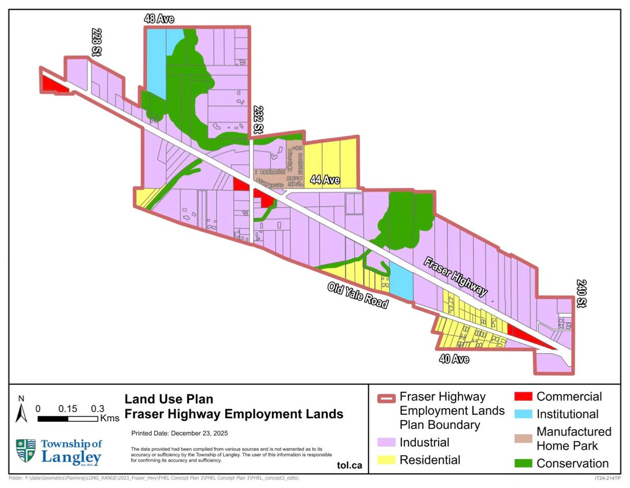
The Township describes the plan for the Fraser Highway Employment Lands as increasing industrial land supply from rural land and creating employment opportunities for residents.
Council endorsed the Fraser Highway Employment Lands Reference Plan on December 15, 2025, and directed staff to amend the Upper Nicomekl River Integrated Stormwater Management Plan to account for industrial land uses in the area.
The plan sounds great: more jobs, more non-residential tax base, and more industrial land in a region that needs it.
But let’s take a closer look at the details.
Is this Agricultural Land Reserve farmland?
Fact Check: Not exactly
The Township’s project page says the area is along Fraser Highway between 228 Street and 240 Street and is not within the Agricultural Land Reserve (ALR). The Reference Plan is more specific, saying the final plan area is about 152 hectares, or 376 acres, surrounded by ALR lands but not including ALR lands.
It is also not just vacant urban land waiting for a warehouse. The Reference Plan says the area is mostly outside Metro Vancouver’s Urban Containment Boundary, and Metro 2050 largely designates it as Rural, with some pockets already designated Industrial.
This is noteworthy because calling it non-ALR land is accurate, but calling it rural land is also accurate. I’m left wondering whether residents are comfortable converting more rural land into future industrial use, even if the ALR boundary itself is not being changed.
Does the Reference Plan already rezone the land to industrial?
Fact Check: No, but it points in that direction
I checked the Reference Plan and it does not establish new land-use designations in the Official Community Plan or Rural Plan. Instead, it identifies lands that may be appropriate for low-impact industrial uses and provides a policy framework for future land use, transportation, mobility, and servicing.
So, technically, this is not the final rezoning step.
Metro Vancouver’s April 2026 Board in Brief says the Township identified the Fraser Highway Employment Lands as a potential Special Study Area and requested that Metro Vancouver bring the area forward for regional consideration. Metro said this would provide a structured mechanism for the Township to continue its analysis while any future regional land-use changes proceed through the Metro 2050 amendment process.
This looks like a planning pathway to me. It does not approve every future building, but it helps prepare the ground for future industrial conversion.
I don’t think this is improper, it’s just bigger than a “reference plan” may sound.
Are the environmental and servicing questions settled?
Fact Check: Not really
The Reference Plan identifies several environmental and servicing issues that still need careful attention. It says the area contains riparian corridors, wetlands, groundwater resources, watercourses connected to salmonid habitat, and five mapped aquifers. It also says some soils near Best Creek and the wetland are poorly drained and structurally unstable, requiring significant drainage infrastructure for industrial development.
The plan also notes that many properties are not connected to regional sewer services and continue to rely on septic systems, while most properties rely on private groundwater wells.
I can see why Council would be interested in this file. Langley needs jobs, a stronger commercial and industrial tax base, and less pressure on residential taxpayers. Those are reasonable goals.
My final questions are: What changes when land moves from Rural to Industrial? What infrastructure is needed first? Who pays for it? What happens to wells, creeks, aquifers, traffic, truck routes, and nearby rural properties?
The Fraser Highway Employment Lands may turn out to be a sensible long-term plan. It may also become one of the more significant rural land-use changes in the Township. I’ll continue to keep an eye out for how this progresses…